Ireland Handy Road Atlas
Anmeldelser af (0)

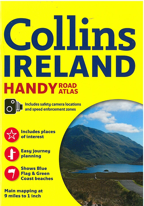
Ireland Handy Road Atlas
Anmeldelser af (0)
Vælg format:
Minimumsbestilling: 1
På lager i 0 butikker.
Forlagsbeskrivelse af Ireland Handy Road Atlas
Explore Ireland with this handy format route-planning atlas in full colour, complete with information on places of tourist interest. There are also fully indexed town centre plans of Belfast, Cork, Dublin, Galway, Limerick and Londonderry. This atlas, at A5 size, contains mapping of the whole of Ireland at 1:570.240. The mapping is beautifully designed with colour classified roads and subtle layered height tinting. The atlas is ideal for residents, visitors and tourists alike. Key features of the atlas include: All Ireland route planning maps. Dublin, Belfast, Cork, Galway, Londonderry and Limerick town centre plans. Blue Flag and Green Coast beaches map. List of tourist information centres. Description of places of interest. Full index to place names and places of interest. Information on airports, ferries and radio stations. Mileage chart.
Detaljer
Forlag
Collins
Udgave
0
ISBN
9780008158644
Sprog
engelsk
Originalsprog
Sproget kan ikke bestemmes
Sider
64
Udgivelsesdato
10-03-2016
Format
Hæftet
Varenr.
2260777
EAN nr.
9780008158644
Varegruppe
Maps/guides
Bogens kategorier
Klik på en kategori for at se lignende bøgerAnmeldelser af Ireland Handy Road Atlas
Brugernes anmeldelser
Andre har også kigget på
✓ Gebyrfrit medlemskab | ✓ Gratis levering for medlemmer | ✓ 365 dages byttegaranti

Ofte købt sammen med
✓ Gebyrfrit medlemskab | ✓ Gratis levering for medlemmer | ✓ 365 dages byttegaranti