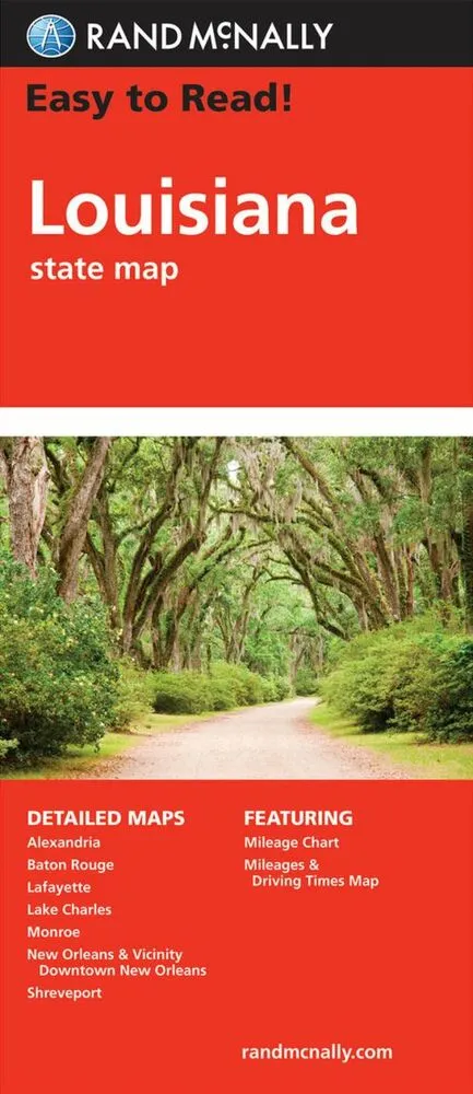
Rand McNally Easy to Read Louisiana State Map
0.0
( 0 )
Engelsk


Rand McNally's Easy To Read State Folded Map is a must-have for anyone traveling in and around Louisiana, offering unbeatable accuracy and reliability at a great price. Our trusted cartography shows a...
På lager i 0 butikker.
Forlagsbeskrivelse af Rand McNally Easy to Read Louisiana State Map af Rand McNally
Rand McNally's Easy To Read State Folded Map is a must-have for anyone traveling in and around Louisiana, offering unbeatable accuracy and reliability at a great price. Our trusted cartography shows all Interstate, U.S., state, and county highways, along with clearly indicated parks, points of interest, airports, county boundaries, and streets. The easy-to-use legend and detailed index make for quick and easy location of destinations. You'll see why Rand McNally folded maps have been the trusted standard for years. - Regularly updated, full-color maps. - 29% larger map with a bigger type size than the Rand McNally Folded Map. - Clearly labeled Interstate, U.S., state, and county highways. - Indications of parks, points of interest, airports, county boundaries, and more. - Mileage and driving times map. - Detailed index. - Convenient folded size. Coverage Area: Detailed maps of: Alexandria, Baton Rouge, Lafayette, Lake Charles, Monroe, New Orleans & Vicinity, Downtown New Orleans, Shreveport.
Detaljer
Forlag
Rand McNally
Udgave
0
ISBN
9780528025754
Sprog
Engelsk
Udgivelsesdato
16-05-2022
Format
Hæftet
Varenr.
3104746
EAN nr.
9780528025754
Varegruppe
Maps/guides
Bogens kategorier Klik på en kategori for at se lignende bøger
Anmeldelser Rand McNally Easy to Read Louisiana State Map
Brugernes anmeldelser
Andre fandt også inspiration i
Flere produkter, som fanger nysgerrigheden hos andre kunder